road gutter map from ballast

i am confused by the graphics of the road contour map. as they state the crown should be highest and gutter should be lowest, why in map the crown is lower than gutter. i thought the road cross slope should be like the red line, right? anyone can explain, really appreciate it.
-

Xu Teng,
Trying to visualize this in 3D will help. I mocked up a quick model for you to review. If you want a "crown" it would have to go up and away. The "higher elevation line" extending forward means a rise along the centerline of the road. See below:


If you were to reverse it, it would create a concave valley along the centerline and all the water would run down the middle of the street (which is actually used frequently in zero curb alleys, backstreets, and roads where curbs are not possible).
Good luck,
Kevin Griendling, AIA
-
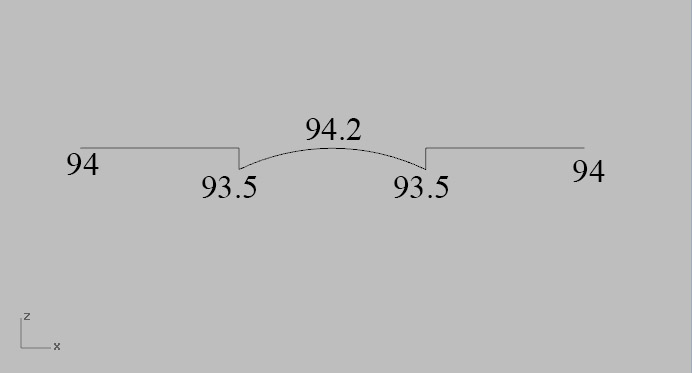
Thank you for your reply. i am not sure if i am right. From your front pic, i can see the section of the road, if i mark the elevation of them, they are of different height, as you can see (the numbers are just made up for illustration). And to put them on the contour map, it is inverse relationship with contour slope line, am i right?
-
Xu Teng,
That is correct.
Kevin Griendling, AIA
-
Xu Teng, actually let me more clear. The single line in the front view is a SECTION cut through the road. NOT a contour line.
Kevin Griendling, AIA
-

One tip to understand contour lines and grading problems is that water always flows from a higher contour line to a lower contour line in a direction perpendicular to the higher contour line. So, for a ridge, water is flowing away from the centerline of the ridge. For a valley or a swale, the water is flowing toward the centerline of the valley.
Gang Chen, Author, AIA, LEED AP BD+C (GreenExamEducation.com)
Please sign in to leave a comment.
Comments
6 comments